About London Aerial Surveys
London Aerial Surveys is a trading name of UAS LONDON LIMITED. We are a professional, engineering-first drone surveying firm specialising in high-precision data capture for civil and construction projects.
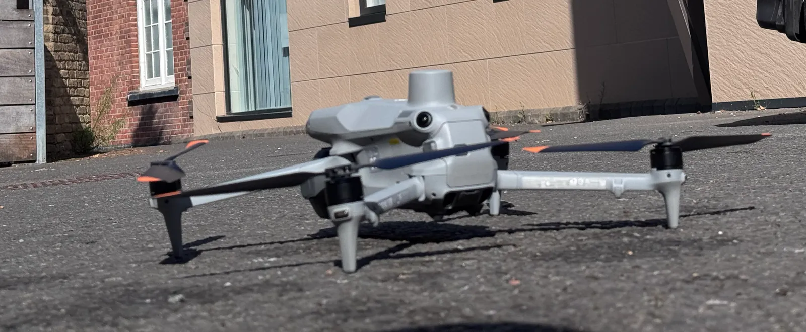 Survey-grade UAV fleet
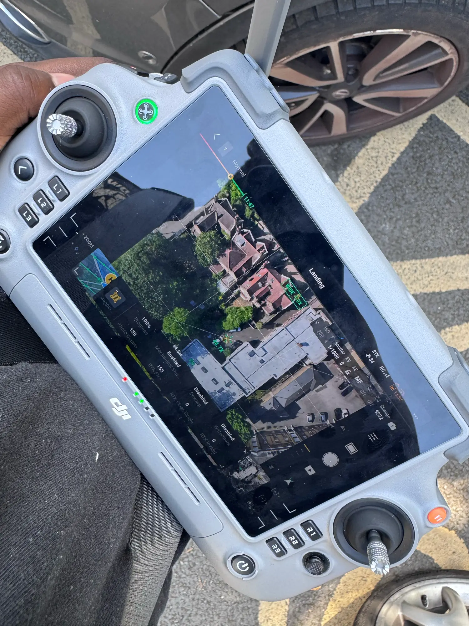 Live RTK survey flight
Survey-Grade Data Capture in the Field
Every mission is flown by qualified pilots using the DJI Matrice 4E with live RTK corrections and a mechanical-shutter camera. Autonomous double-grid flight plans capture hundreds of overlapping, distortion-free images that are stitched into millimetre-accurate orthomosaics, point clouds, and 3D models.
Our Safety-First & Data-Driven Philosophy
At London Aerial Surveys, we believe that drone surveying is not merely about taking photos from above. It is a precise engineering discipline. We bridge the gap between advanced drone operations and traditional land surveying, delivering coordinate-matched spatial files that import directly into Autodesk Civil 3D, QGIS, or Revit.
We operate exclusively in the **surveying** sector. We do not provide creative wedding photography, event videography, or general marketing media. Every mission we plan, fly, and process is focused on technical data capture—whether that involves topographical contours, digital terrain models (DTMs), measured roof plans, or classified LiDAR point clouds.
Compliance & Airspace Standards
Operating drones in Greater London requires strict compliance with safety codes and privacy laws. We coordinate all logistics, including:
- Acquiring flight permissions from airport air traffic controllers (ATC)
- Submitting digital notifications via the NATS airspace management network
- Establishing strict ground safety cordons and takeoff zones
- Executing flights with dual-GPS redundancy and fail-safe return functions
Our Capabilities & Standards
How we guarantee safety, accuracy, and efficiency on every site survey.
CAA Operational Authorisation
We hold formal authorisation from the Civil Aviation Authority allowing us to operate commercial drone flights within congested urban areas across London.
£5m Public Liability Insurance
Every operation is covered by comprehensive aviation liability insurance, meeting all EC 785/2004 requirements for commercial UAV flights.
Survey-Grade UAV Fleet
Our primary platform is the DJI Matrice 4E with RTK corrections and a mechanical shutter, ensuring absolute spatial tolerances of ±15mm to ±30mm.
Qualified Survey Personnel
Our flights are planned and conducted by qualified drone pilots working alongside experienced land surveying professionals to verify engineering deliverables.