Photogrammetry 2D & 3D Mapping in London
High-resolution, scale-accurate photogrammetric reconstructions mapping complex development sites and land parcels.
From £950 + VAT — build an instant estimate↓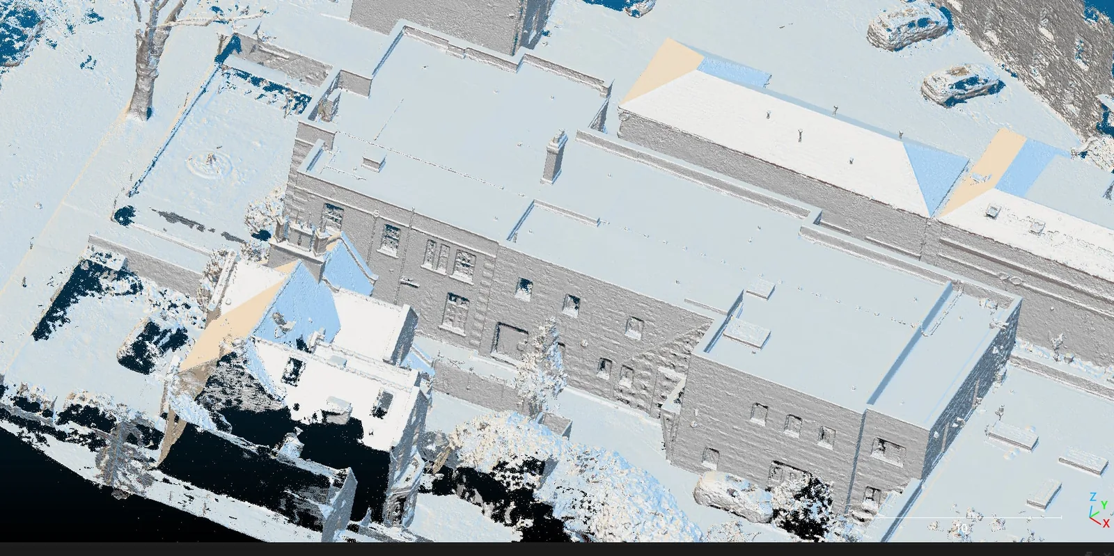 Photogrammetry & 3D Mapping
Service Overview
Our photogrammetry mapping services convert hundreds or thousands of high-resolution aerial images into measurable, geo-referenced 2D and 3D digital models. Using the DJI Matrice 4E's mechanical shutter camera, we eliminate motion blur to capture exceptionally sharp details. The resulting models allow project stakeholders to measure distances, areas, and coordinates directly on their computers, providing a complete spatial record of the site.
Want a ballpark price now?
Build a no-obligation estimate for photogrammetry 2d & 3d mapping in seconds.
Key Benefits
Accuracy & Methodology
We map the site with systematic flight lines using a high-resolution drone camera. Images are captured with standard lateral and longitudinal overlaps (75%–85%). Ground reference coordinate targets are placed and surveyed using RTK-enabled GPS. Advanced photogrammetry engines stitch these images by matching homologous points, orienting the cameras, and scaling the result based on ground constraints.
Data & Deliverables
We export high-density spatial datasets ready for ingestion in leading architectural and civil engineering software.
- Ultra-high resolution Orthomosaic site maps (sub-centimetre GSD)
- Fully textured 3D Meshes (.OBJ / .FBX / .glTF format)
- High-density 3D Point Clouds (.LAS / .LAZ / .E57 format)
- Interactive web-based 3D models for stakeholder viewing
Service Specific FAQ
Q: Is the data compatible with standard CAD and GIS software?
Yes. All our photogrammetric data is exported in standard formats (.LAS, .DWG, .GeoTIFF) that can be imported directly into AutoCAD, Civil 3D, ArcGIS, QGIS, Revit, and other major design packages.
Q: How long does the processing take?
Stitching and calibrating large datasets usually takes 24 to 48 hours following field data capture, depending on the site size and density of the photos.