3D Laser Scanning in London
Survey-grade terrestrial 3D laser scanning capturing millimetre-accurate point clouds of buildings, interiors, and structures across London.
From £1,250 + VAT — build an instant estimate↓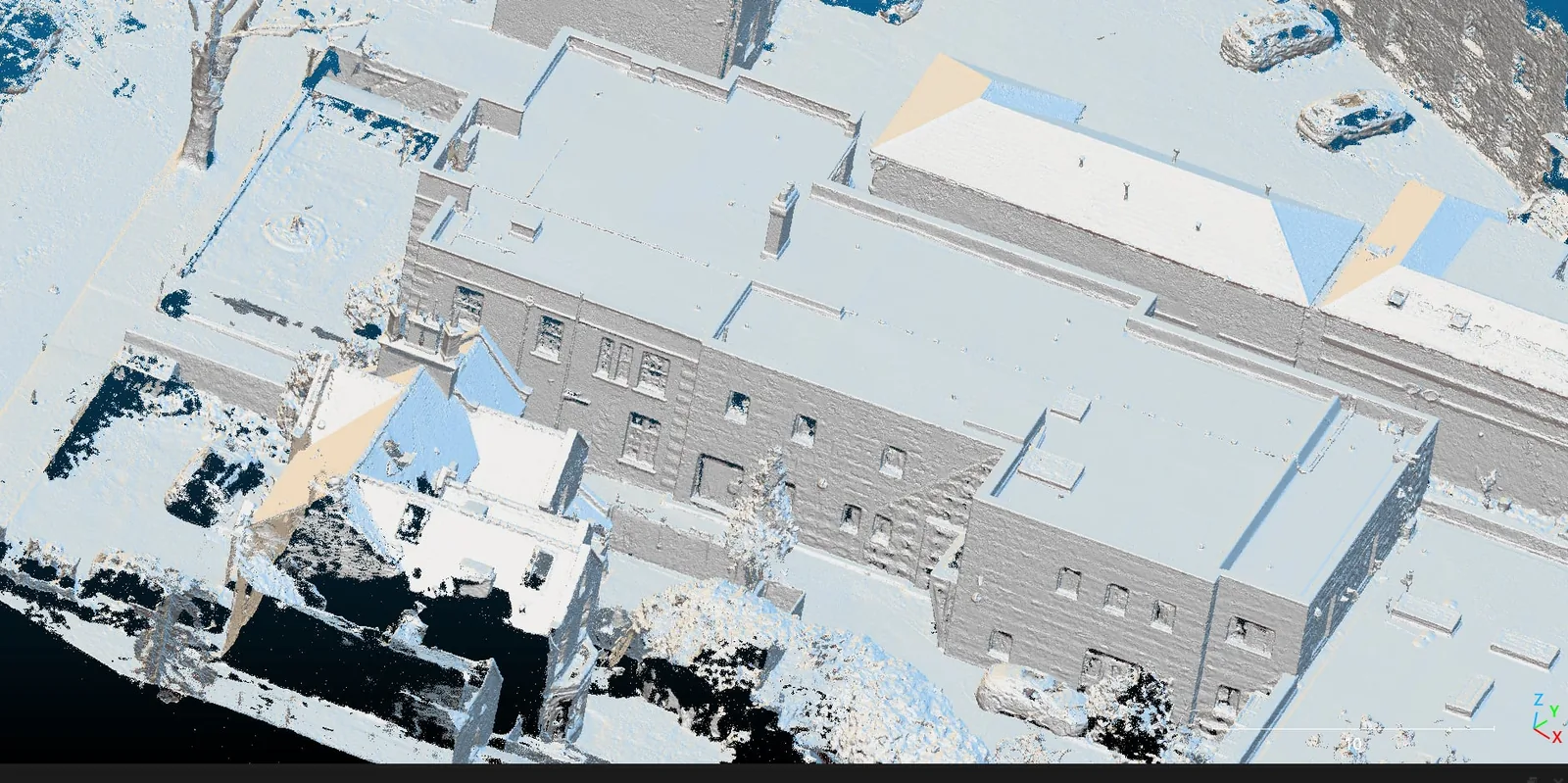 Measured Building Surveys & Laser Scanning
Service Overview
Our 3D laser scanning service captures the precise geometry of buildings, interiors, plant rooms, and structures as a dense, fully registered point cloud. Using survey-grade FARO-class scanners, each scan station records millions of measured points per second, which we register together into a single coordinated dataset accurate to a few millimetres. The result is a complete digital twin of the existing asset — every wall, beam, riser, and service captured exactly as built. Architects, structural engineers, and BIM coordinators use this data as the authoritative 'as-existing' base for refurbishment, retrofit, and clash-free design, removing the guesswork and costly re-measures that plague projects working from outdated drawings.
Want a ballpark price now?
Build a no-obligation estimate for 3d laser scanning in seconds.
Key Benefits
Accuracy & Methodology
We establish a control network across the site and position the laser scanner at a planned series of stations to guarantee full coverage with no occlusion shadows. Each scan captures a 360° spherical sweep with HDR imagery for true-colour points. Back in the office, we register the scans together against the control network, verify registration error, and decimate and clean the cloud before modelling or drawing extraction.
Data & Deliverables
We export high-density spatial datasets ready for ingestion in leading architectural and civil engineering software.
- Registered, colourised 3D point clouds (.RCP / .E57 / .LAS)
- Scan-to-BIM Revit models at the specified Level of Detail (LOD 200–350)
- 2D measured CAD plans, elevations, and sections (.DWG)
- Web-hosted point cloud viewer for remote stakeholder access
Service Specific FAQ
Q: How is laser scanning different from a drone photogrammetry survey?
Laser scanning is ground-based and excels at interiors, plant rooms, and tight structural spaces where it delivers a few millimetres of accuracy. Drone photogrammetry is the better tool for roofs, large sites, and external envelopes. On complex projects we routinely combine both — terrestrial scans for the interior and aerial capture for the roof — and register them into one unified model.
Q: Can you produce a Revit (BIM) model from the scan?
Yes. Scan-to-BIM is one of our most requested deliverables. We model the registered point cloud into a parametric Revit model at the Level of Detail you specify, so your design team starts from an accurate, coordinated existing-conditions model rather than re-drawing from old paper plans.