MEP Design & BIM Coordination in WC2H
Coordinated, clash-free mep design & bim coordination built on accurate existing-conditions surveys for projects across Postcode Sector WC2H (West Central London).
 MEP Design & BIM Coordination · WC2H
MEP Design & BIM Coordination in WC2H
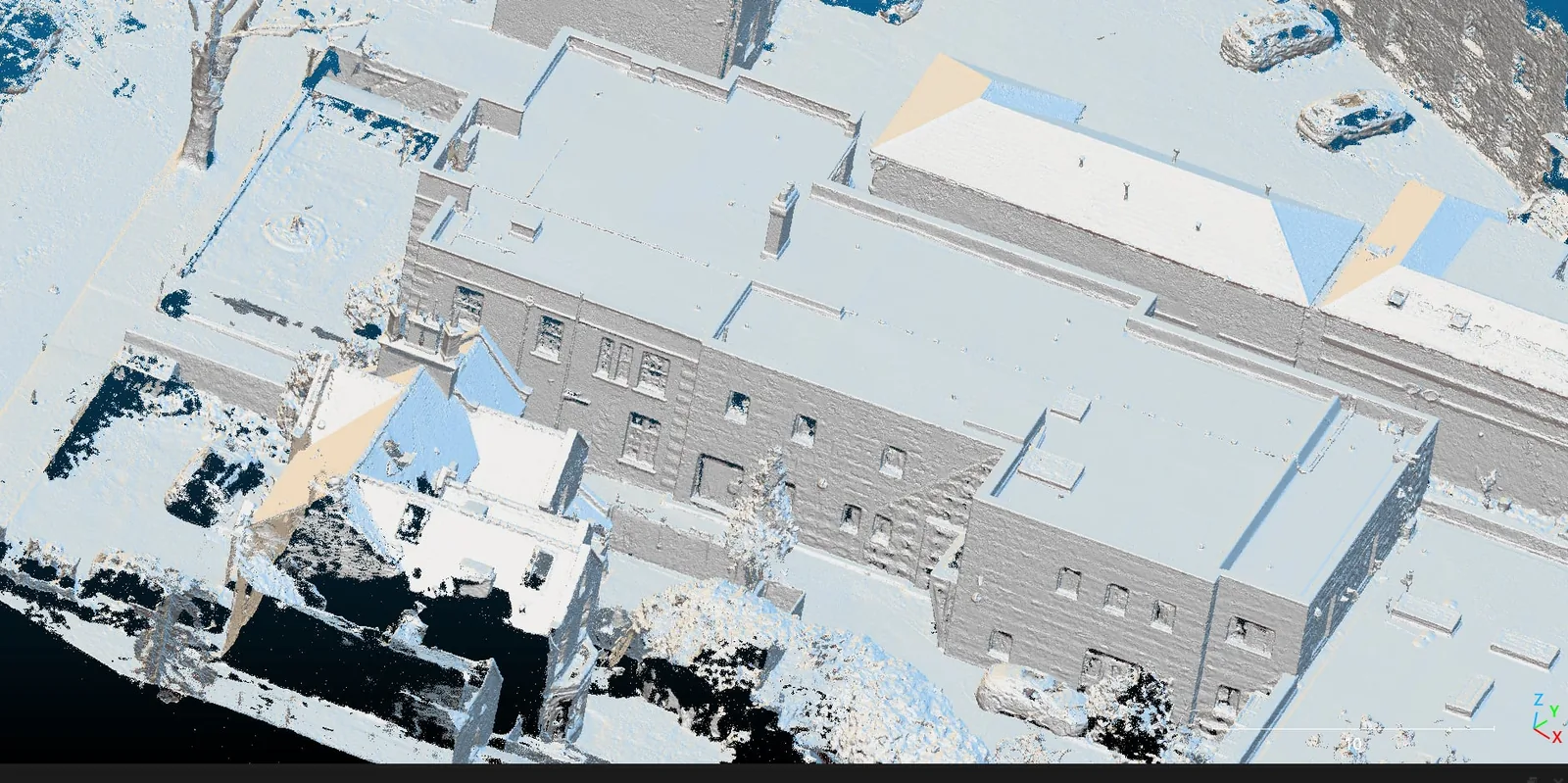
Delivering mep design & bim coordination in WC2H works best when the design is built on an accurate record of the real building. London Aerial Surveys (a trading name of UAS London Limited) pairs in-house survey and laser-scanning capability with MEP design and BIM coordination, so the heating, ventilation, power, lighting, and drainage are modelled against the genuine ceiling voids, riser sizes, and structural openings — not assumptions. Working across refurbishment and fit-out projects in WC2H, we resolve service conflicts in the model and issue a buildable, coordinated set of drawings and a federated model that installs first time and keeps the programme on track.
Want a ballpark price now?
Build a no-obligation estimate for mep design & bim coordination in seconds.
How We Work in WC2H
Our approach to mep design & bim coordination in WC2H runs through four stages: 1. **Existing-Conditions Survey**: We laser scan or measure the building in WC2H so the design reflects the real constraints of the structure. 2. **3D MEP Modelling**: Each service — mechanical, electrical, and public health — is modelled in 3D to the agreed Level of Detail. 3. **Federation & Clash Detection**: The MEP model is federated with the architectural and structural models and run through clash detection to resolve conflicts on screen. 4. **Coordinated Issue**: We issue the coordinated model plus 2D design, installation, and builders'-work drawings for construction.
Typical MEP Design & BIM Coordination Projects in WC2H
Survey Deliverables
Why Choose Us for WC2H Operations
Location FAQ
Q: Do we need a survey before MEP design can start in WC2H?
For refurbishment and fit-out in WC2H, an accurate existing-conditions survey is what makes coordination reliable — it captures the real ceiling voids, riser sizes, and structural openings the services must fit around. We can deliver the laser scan and the MEP design as a single coordinated package.
Q: Which software and formats do you work in?
We model in Revit and coordinate in Navisworks, issuing native models alongside 2D .DWG and PDF drawings. We work to your BIM Execution Plan, shared coordinate system, and naming standards so our outputs federate cleanly with the rest of the project model.
Coordinated to the project BIM Execution Plan. Clash detection report issued alongside the federated model.