Pre-Construction Site Surveys in London
Comprehensive baseline data capture to document existing site conditions, levels, and neighbouring assets before works begin.
From £1,200 + VAT — build an instant estimate↓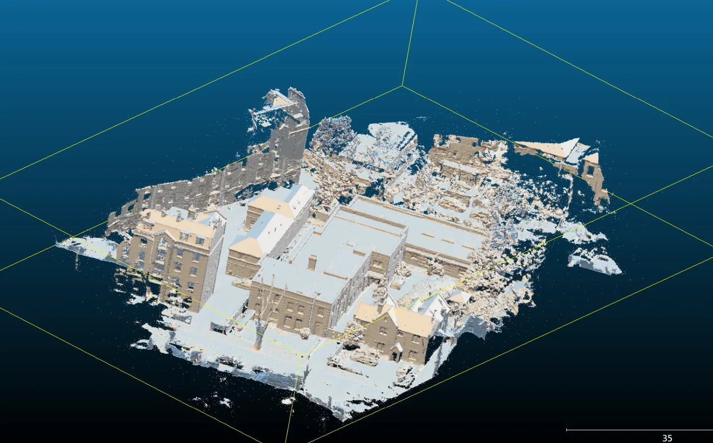 Construction & Engineering Surveys
Service Overview
Before breaking ground on any construction project in London, establishing an accurate, indisputable site baseline is essential. Our pre-construction drone surveys capture the exact topographical layout, boundary points, and conditions of adjacent buildings, pavements, and utilities. This technical dataset provides design teams with perfect starting models and protects developers from false third-party dilapidation and boundary claims.
Want a ballpark price now?
Build a no-obligation estimate for pre-construction site surveys in seconds.
Key Benefits
Accuracy & Methodology
We conduct a thorough pre-flight risk assessment and acquire the necessary permissions for urban flight. The pilot maps the site boundaries and neighboring structures. High-resolution orthomosaics and 3D textured models are generated, focusing on interface areas, roadways, and structural joints. All outputs are calibrated to local coordinates.
Data & Deliverables
We export high-density spatial datasets ready for ingestion in leading architectural and civil engineering software.
- Complete 3D baseline site models and point clouds
- High-resolution geo-referenced site overview maps
- Dilapidation and structural condition photo datasets with GPS tagging
- CAD boundary overlays matching legal land registry plans
Service Specific FAQ
Q: How do you coordinate surveys in dense London construction sectors?
We handle all airspace coordination, including filings through the CAA, notifying local borough councils, and coordinating with nearby airports or Heliports (e.g. the London Heliport). Our pilots are highly experienced in operating within restricted urban zones.
Q: Can we use this data for building information modelling (BIM)?
Yes. The point clouds and 3D meshes we deliver can be imported into Autodesk Revit, ArchiCAD, and other BIM applications to act as the primary 'as-existing' model.